The Best Hikes in Lofoten with Map
The Lofoten Islands are every outdoor enthusiast and photographer’s dream. Hikes here offer dramatic views of deep fjords and jagged peaks that rise several 100 meters above the Norwegian Sea. In contrast lie serene Norwegian villages against a picturesque backdrop of turquoise waters.
Most hikes on the Lofoten archipelago have elevation gain of 1000 meters or less. Although this makes them moderate day hikes, do not underestimate their difficulty levels. Some of them are steep, climbing hundreds of meters in a short distance, so much so that the summits are almost visible from the trailhead. If you are someone that enjoys camping outdoors, you can convert some of them to overnight camping trips. However, definitely take into account the unpredictability of weather conditions before venturing out, even in the summer months. It could change from being warm and sunny one day to cold and rainy the very next.
Lofoten Hiking Trail Map
Best Hikes in Lofoten Islands (Region-Wise)
Svolvær Region – Austvågøy Mountain Hikes
• Festvågtinden
Leknes Region – Vestvågøy Mountain Hikes
• Offersøykammen
Nusfjord Region – Flakstadøy Mountain Hikes
• Stornappstinden
Reine Region – Moskenesøy Mountain Hikes
• Reinebringen
• Ryten and Kvalvika Beach
• Munken
• Tindstinden
Væroy Mountain Hikes
• Håen
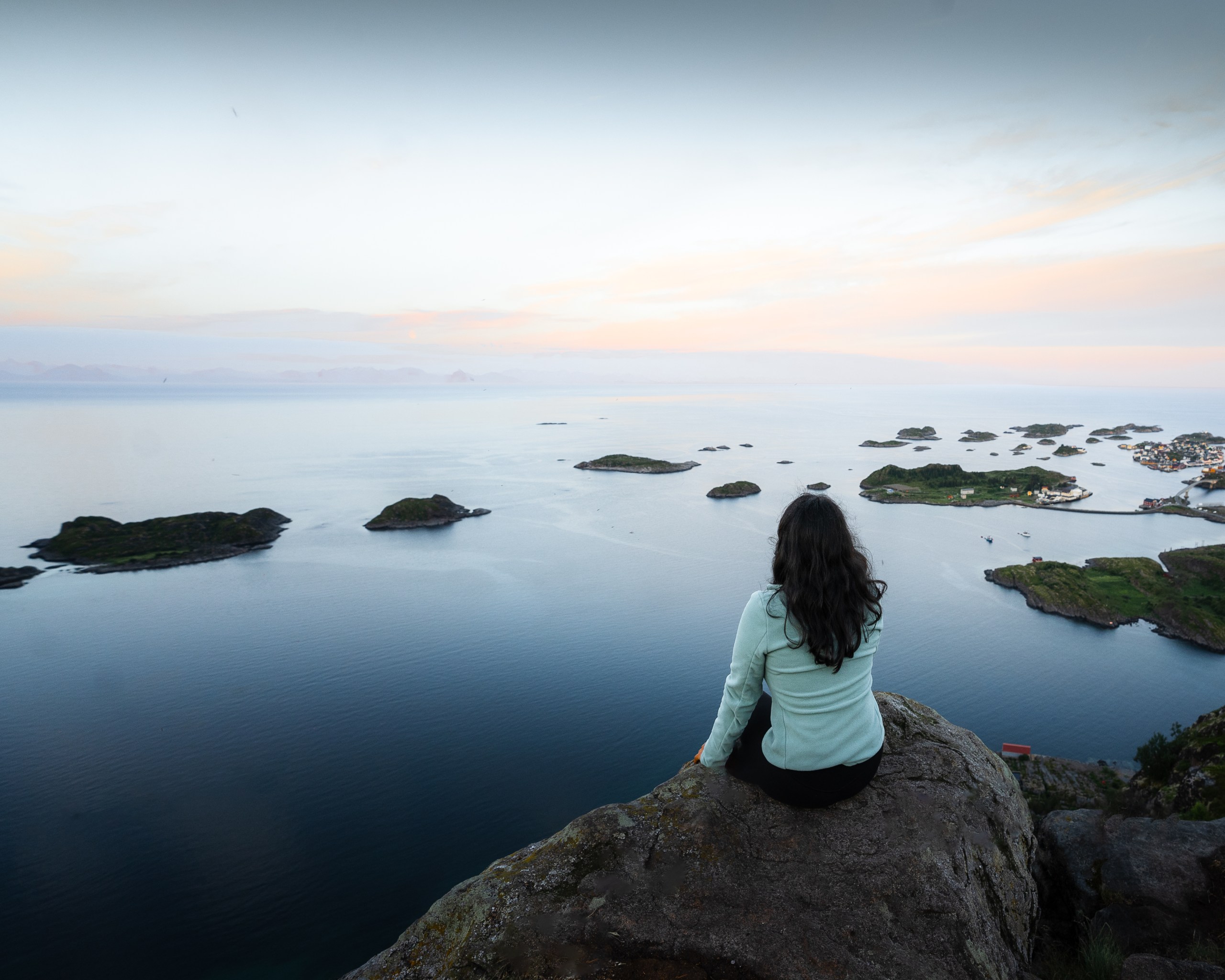
Pro Tip: Because of its location, trails in the Reine region offer best chances of viewing the midnight sun.
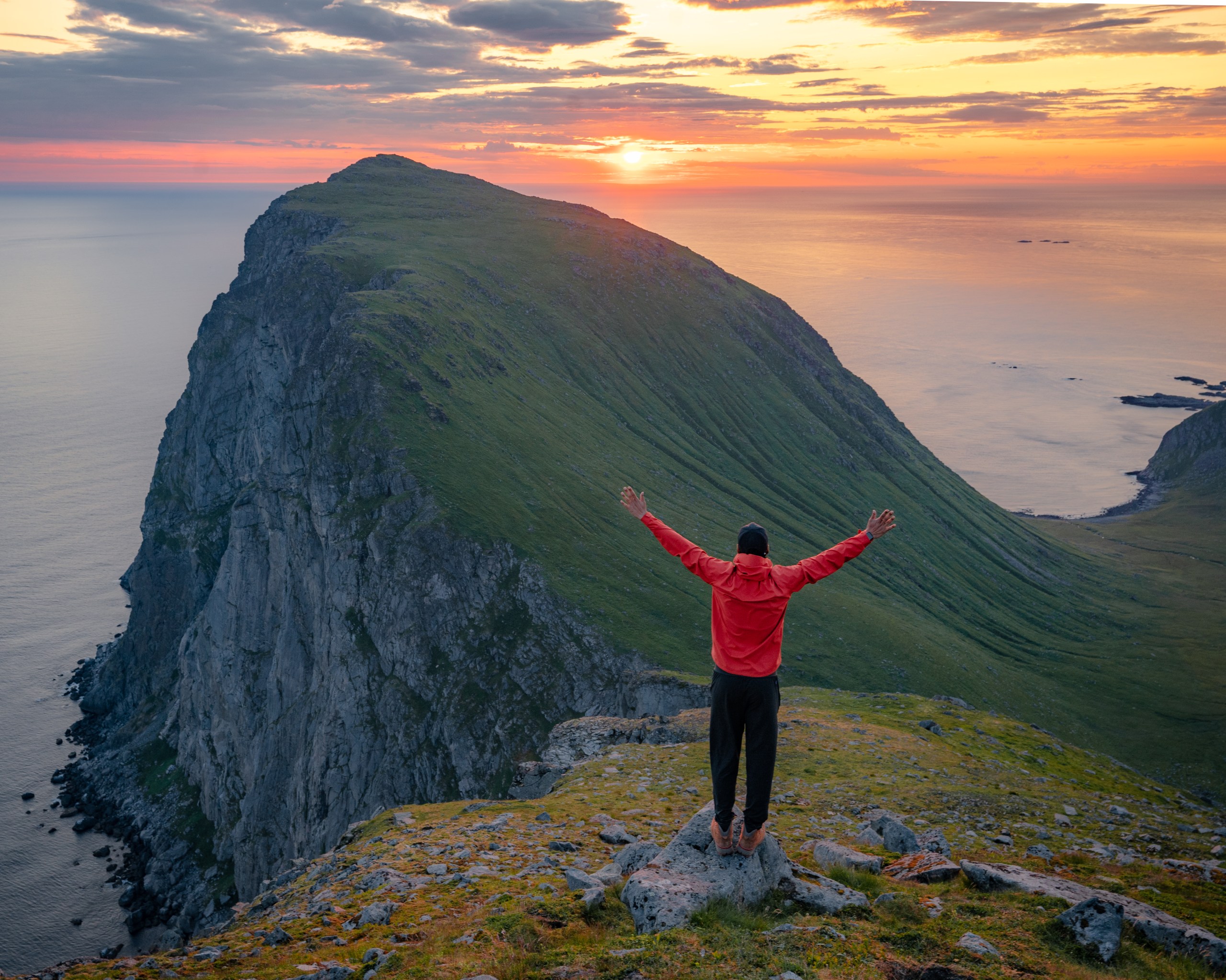
Festvågtinden Trail
- Distance : ~1.5 miles Out & Back
- Time : ~3-4 hours
- Elevation gain : 1774 ft
- Rating : Moderate
- Camping : Allowed
The trailhead is on the roadside but almost fully shrouded by bushes. One of those hikes that seem to rise almost vertically and the peak is visible from the trailhead. The first half mile is steep and requires crossing a massive boulder field. Just across the boulder field, a well worn muddy trail leads to a lake. Between the lake and summit there are numerous social trails but stay to the right as far as possible.
At the summit, you get panoramic views of mountains surrounding the beautiful fishing village of Hennigsvær. See if you can spot the famous soccer field of Hennigsvær known to be one of the most picturesque soccer fields in the world! This hike with it’s views is a typical representative of hikes on the Lofoten islands. This is a great option if you have some time in hand when exploring the Svolvær-Hennigsvær region and looking for a warm up hike.
Parking: This parking lot is free and next to a large building on the way to Hennigsvær – Click here for directions
Offersøykammen Trail
- Distance : ~1.4 miles Out & Back
- Time : ~2-3 hours
- Elevation gain : 1332 ft
- Rating : Moderate
- Camping : Allowed on the ridgeline just before the summit
Needless to say, some sections of this trail have steep ascent and very slippery descent. Not much for views on the trail. The steady ascent and monotonous views throughout the way up may make you wonder if this trail is even worth the effort. But keep going because the views from the summit are out of this world!
As we made our way up to the summit, a thick blanket of clouds started to drift making way for some incredible views of turquoise waters and rugged mountains in the backdrop. So don’t be disappointed when you reach the summit and the views are obscured by clouds and fog, which is a pretty common experience here. Give it a few minutes and watch the clouds eventually drift revealing breathtaking views.
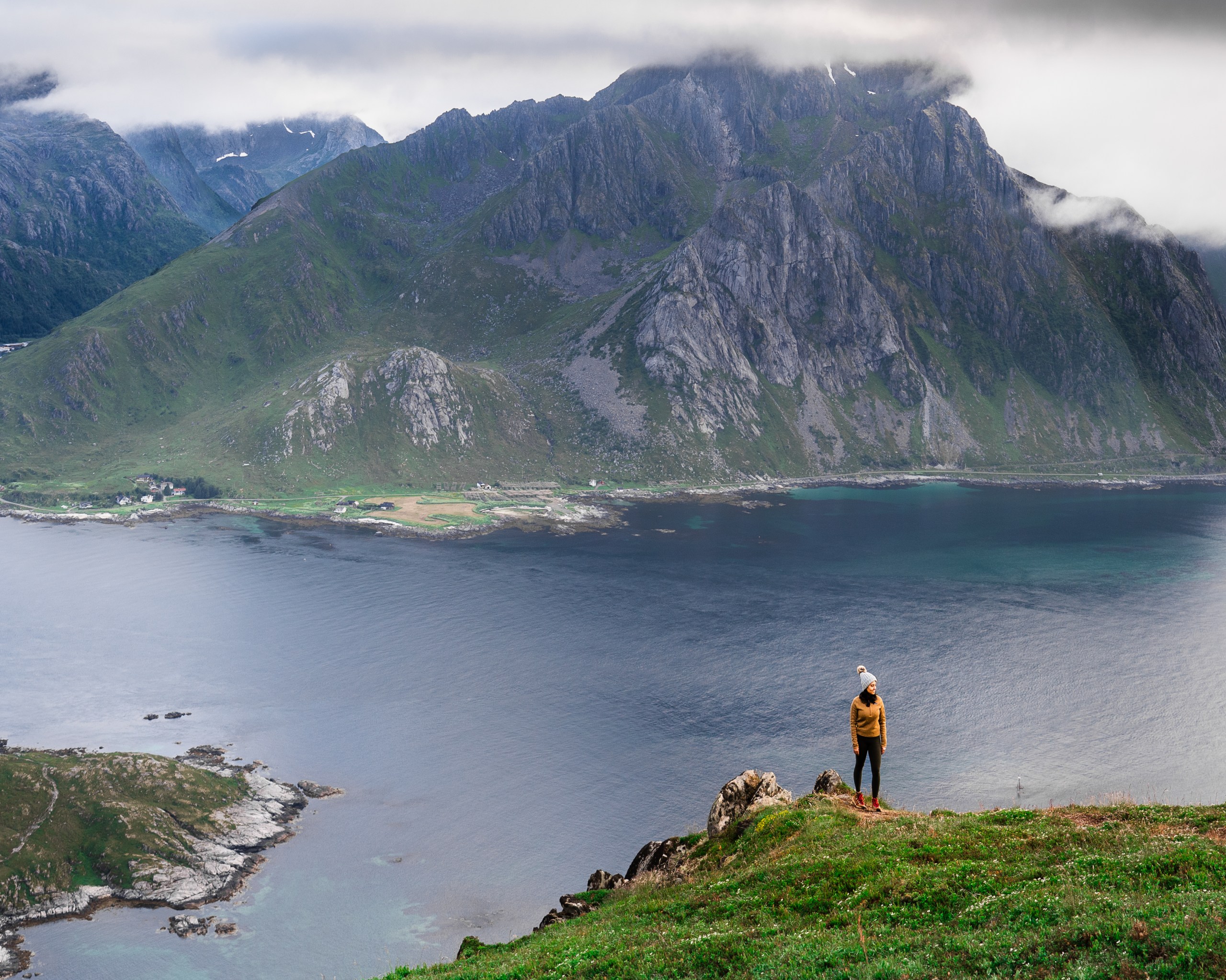
We definitely recommend this hike as it is relatively easier compared to other hikes on the island.
Parking: There is a parking lot in the Skreda Resting Area from where the first section of the trail is shorter and steeper – Click here for directions. The hike up the first section is slightly longer but more gradual from an alternate parking lot near the Nappstraum tunnel – Click here for directions.
Reinebringen Trail

- Distance : ~3.6 miles Out & Back
- Time : ~3-4 hours
- Elevation gain : 1814 ft
- Rating : Strenuous
- Camping : Not Allowed
A classic Lofoten hike and the most popular on the island for good reason. Not surprisingly, it is crowded at all times during summer months. You will see layers of mountains standing tall above beautifully formed fjords and the Norwegian Sea.
The entire hike has stone stairs, over 1978 of them leading up to the summit which makes the hike straightforward without need for route finding. Despite the stairway, this is by no means an easy hike. The summit is a narrow ridge where you could find a safe perch and enjoy the views. If you are feeling more adventurous, you could go in either direction to climb further up the peaks. But keep in mind that beyond the stairway the trail is unmaintained, muddy and could get really sketchy when slippery. Those with fear for heights could find the descent down the narrow stairway especially challenging.
Parking: Reinehalsen Viewpoint : This is the closest to the trailhead. But since it is also a very popular viewpoint, finding a spot here is not easy. Parking is limited to 4 hours here. Djupfjord Viewpoint: This is where we parked. Parking here is free and is the largest parking lot in the area. The trailhead is approximately half a mile walk along a bridge from here. Other parking options are Ytre Havn (Inner Harbor), Reine and Reine Kultursenter. Most of these are paid parking.
Ryten Trail Overlooking Kvalvika Beach
- Distance : ~4.5 miles Out & Back
- Time : ~4-5 hours
- Elevation gain : 1922 ft
- Rating : Moderate
- Camping : Allowed at Kvalvika beach
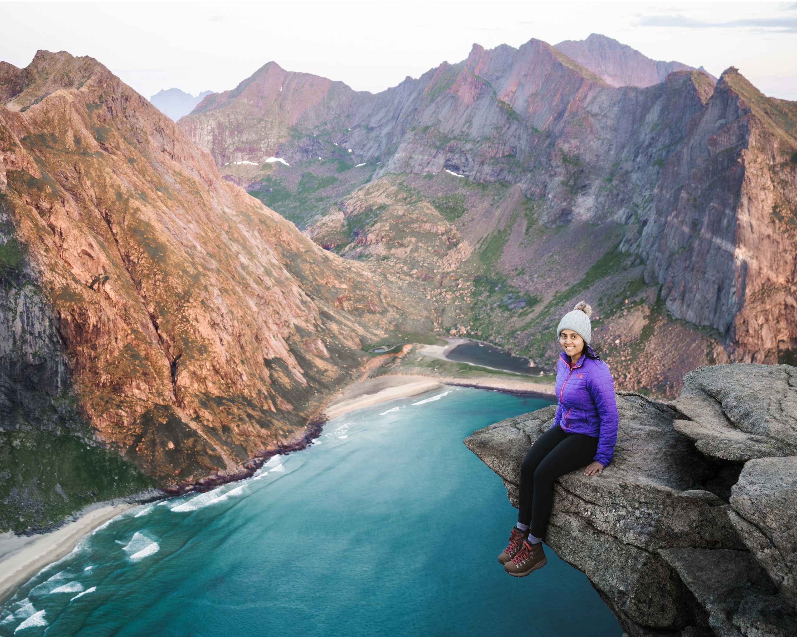
This has been our personal favorite on the Lofoten Islands. Not too crowded if hiked late at night during summer months and brilliant, expansive views right from start. The contrast of emerald green waters of Kvalvika beach against the surrounding craggy peaks are views worth witnessing at least once in a lifetime. If you are like us and stop often to admire views and take pictures, then we highly recommend allocating more time for this hike.

By Lofoten standards, this trail is less steep and strenuous but still not to be taken lightly. The views will make up for all the effort. We started from the trailhead around 9.30pm and reached the summit just in time to witness the midnight sun in it’s full glory.
A little over a mile from the trailhead, a small detour trail goes down to Kvalvika Beach. You could do it along with Ryten hike which will add an extra 2 miles and 1000 feet of elevation gain to the existing hike. We chose not to do it as it would make for a very long and tiring night.
Parking: There is a paid, private parking lot right next to the trailhead – Click here for directions
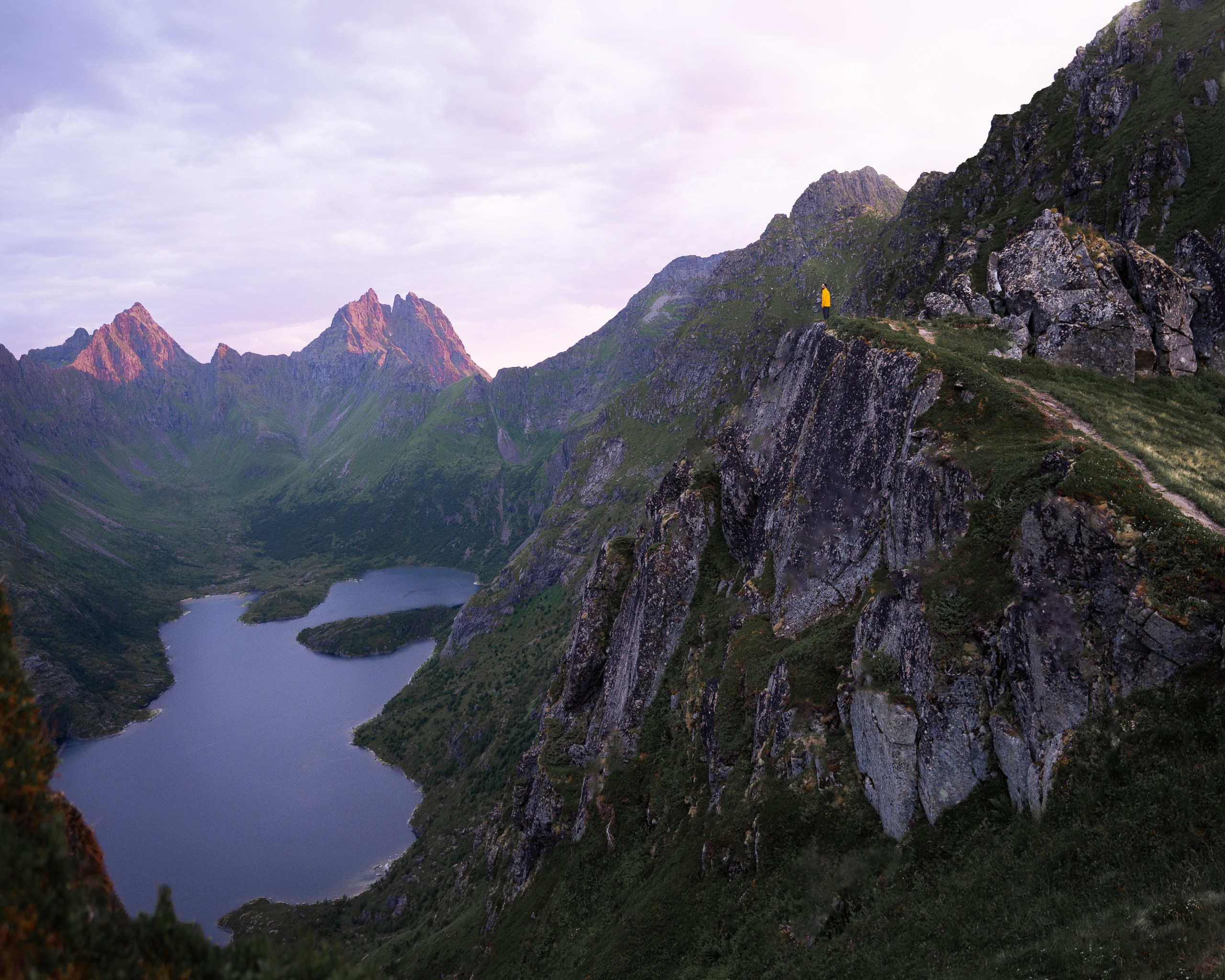
Tindstinden Trail
- Distance : ~3.4 miles Out & Back
- Time : ~3-4 hours
- Elevation gain : 1475 ft
- Rating : Challenging
- Camping : Allowed
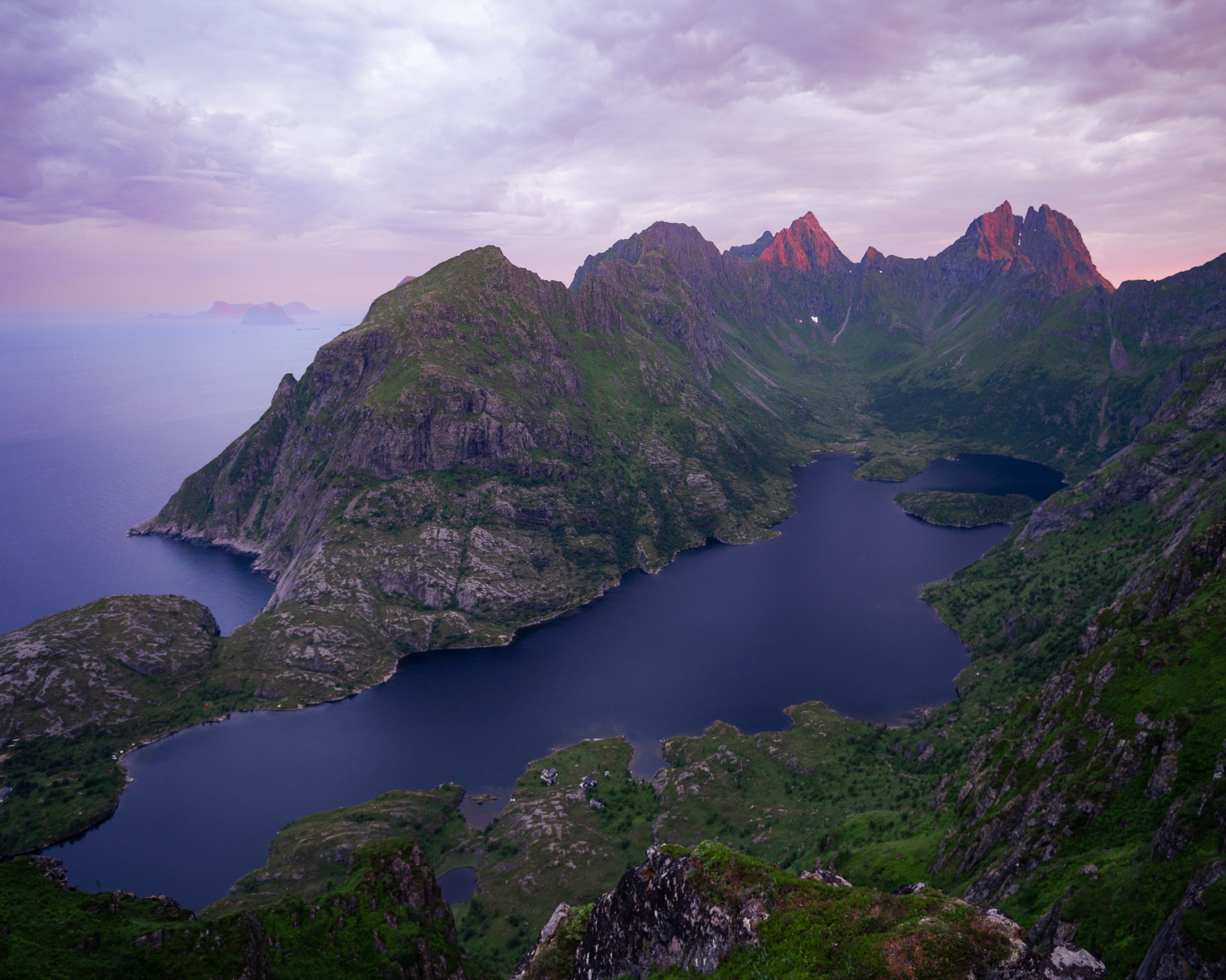
This is a lesser known hike on the island but by no means any less picturesque. The summit holds majestic views of mountains, and lakes extending into the ocean. The trail starts off with a gradual ascent and views of a waterfall. The mid section of the trail gets slightly steeper and has ropes and chains to help with descent. The last section of the trail is very steep, some of it involves crossing boulders and finally a muddy, narrow ridge leading up to the summit. Descending the ridge could get challenging to those with fear of heights as the trail itself is very narrow and muddy with almost 70% gradient.
We highly recommend avoiding this hike when it rains as it could get slippery and treacherous.
Parking: Paid parking lot in Sørvågen – Click here for Directions
A few other trails that we highly recommend hiking are listed below. Because of inclement weather on some days and thereafter our time on the island running out, we could not make it to them. These are at the top of our list for the next time we visit the Lofoten Islands.
- Munken
- Stornappstinden
- Håen
